
Browse Terra Alta Property Records
Start with an address. The Preston Assessor and the mapWV parcel search both work from a street address or an owner of record. Confirm the parcel first. Names shift here. The County Clerk records the deed and plat, while the Sheriff handles the tax bill. The town office keeps permits, zoning, and utilities. No searchable permit register appears on its public pages, so request older files from the office itself.
- Search current Terra Alta street or owner details in the Preston Assessor portal.
- Try Portland, Cranberry Summit, and Cranberry as historic name clues when an older entry is missing.
- Compare the legal description and parcel key with the latest County Clerk deed.
- Use the Sheriff ticket inquiry for tax payment, then Atlas or mapWV for location context.
- Ask the town office directly for any permit, zoning, or ordinance file tied to the parcel.
Terra Alta’s historic-name problem trips up many searches. The property search workflow for Preston County explains each assessment field, and those definitions matter here.
Where Terra Alta Records Are Kept
Terra Alta property records live at the Preston County courthouse, not at the town hall. Deeds, tax parcels, assessment values, and recorded plats are all county holdings. The town handles different paperwork entirely. Municipal files cover utilities, permits, zoning, and ordinances.
Terra Alta’s own site does offer e-payment links. Residents can pay combined utility bills, water deposits, fire fees, police tickets, and rental fees online. Those links are not an ownership search. They settle accounts, not title questions.
Preston County publishes no public permit or zoning index with address fields, date coverage, or fee schedules. For those local records, contact the town directly.
Preston County Records (deeds, taxes, parcels)
County instruments, parcel assessments, and tax tickets use separate systems.
Terra Alta Town Services
Contact the town office about permit, zoning, and ordinance records.
Searchable permit fields were not verified.
Terra Alta Plats, Places, and Property Records
Formal subdivision-plat names and parcel prefixes for Terra Alta remain unverified. What the record does show is a sequence of place names and geographic lenses. They are worth using in a county search. Treat the table below as a toolkit. It gathers search terms and record questions. It does not claim every area is a named subdivision inside the municipal line.
Before you cite a lot or block, ask the County Clerk for the plat reference. That one step settles whether the name is official or just local habit. Terra Alta’s property records reward that caution.
| Neighborhood / Subdivision | Era | In the Records |
|---|---|---|
| Cranberry settlement | Local history dates settlement to 1853 | Try the place name with owner and legal description |
| Cranberry Summit | Railroad-era name in local history | Check older deeds, directories, and plats |
| Portland charter area | Earlier official town name; before Terra Alta incorporation | Search the former name; exact plat not verified |
| Terra Alta town core | Incorporated under current name in 1890 | Use modern situs and county parcel key |
| Alpine / Hopemont approach | Nearby geography; town-line status needs checking | Confirm municipality and parcel location |
| Cranberry glade surroundings | Rural setting, no subdivision era verified | Use legal description and map card |
Search an older lot under every known name first. Then let the parcel key and deed description settle the match. The Preston County parcel maps page covers map cards and the difference between a GIS shape and a recorded plat.
Terra Alta Property Records and Former Names
Old papers may call this town something else. The official town history says Terra Alta was first chartered as Portland and incorporated under its present name in 1890. Local histories add more names. Cranberry and Cranberry Summit both appear in older accounts. Those variants matter for deed records. An older instrument may carry a name the current town label will never match in a property records search. Keep the old wording intact, and compare the legal description before tying a past reference to a present parcel number.
Terra Alta’s official town site documents the town’s history and former names.
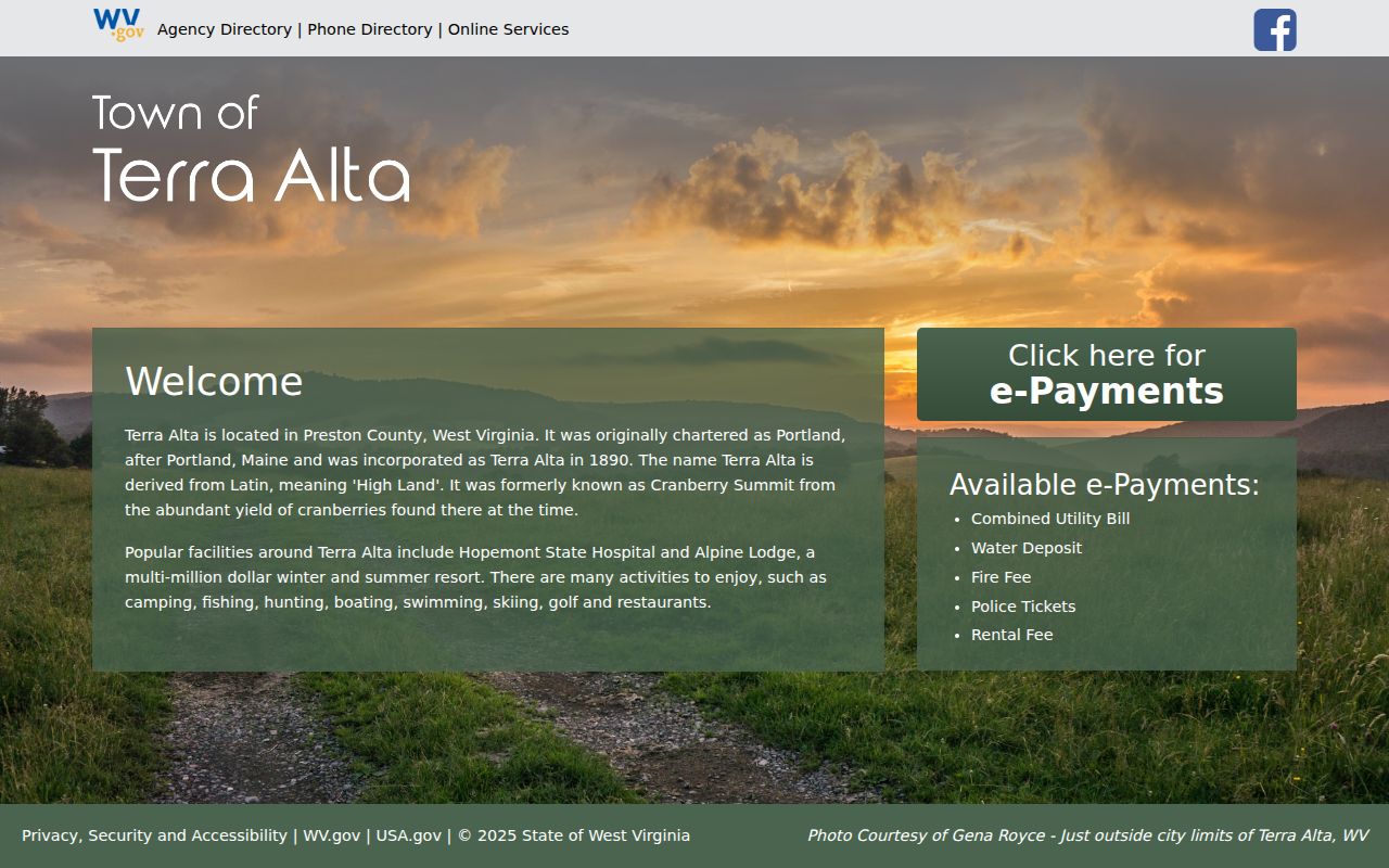
The town page fixes names; the deed fixes land.
Terra Alta Parcel Search and Railroad Geography
Geography shaped this town's records too. Local history puts Terra Alta at 2,582 feet. The same accounts identify the Baltimore & Ohio Railroad's highest point along the route nearby. Cranberry Summit and the rail corridor still surface in old deeds, directories, and newspapers. None of that marks a town limit. Those names are not subdivisions either. Treat them as search vocabulary for a Preston County parcel search, then confirm the land with a recorded plat or the legal description. A Preston County community chronology separates Terra Alta's timeline from Kingwood's courthouse history and Masontown's town layout, and the community history index can steer a search by date or place name.
The county community timeline adds settlement and railroad context to Terra Alta records research.

The chronology gives names; the Clerk gives deeds.
Terra Alta Parcel Search at ZIP Boundaries
Terra Alta uses the ZIP code 26764. Mail routes say nothing about the incorporated line, though. PO-box and rural-route crossings sit outside the postal label, so a Terra Alta mailing address can describe Preston County land well beyond the town limits. Town permits follow boundaries, not mail. Before paying a municipal levy, confirm the parcel location with the town and the Preston County Assessor.
Note the original address and any corrected situs label. Next, compare the mapWV district and parcel components. Then check the municipal boundary separately, since the ZIP and the mailing city cannot settle it. The legal description, not the postal label, is what ties a parcel to a deed or plat in the property records.
Terra Alta Property Record Town Services
Terra Alta's official site offers e-payment for combined utility bills. Water deposits, fire fees, police tickets, and rental fees can be paid there too. Those payment pages prove town-level records exist. They hold no searchable ownership, permit, or zoning register, though. A utility account is a billing record, not a deed record. So property records questions still lead back to the county recorder and assessor.
Ask the town which custodian keeps a historic permit or land-use decision. Include the address and parcel key if known. Name the permit or zoning record you want. Ask whether a paper or electronic copy is available. The town's permit pages publish no search fields, date coverage, copying fees, or response times. So plan on asking directly.
Terra Alta Property Permit Search
Terra Alta publishes no online permit or zoning index. Its e-payment links cover listed town services only. None of them works as a building-permit search. Call the town office and ask directly who holds permits and zoning decisions. Then confirm whether a parcel history can be searched by street. Ask about application number, applicant, work type, or date. Treat those fields as questions to ask, not guaranteed portal filters.
A municipal permit traces approvals and improvements over time. It proves no ownership, clears no title, and fixes no surveyed boundary. For Terra Alta property records, tie any town document to the county parcel. Use its address and legal description. Then confirm title with the County Clerk.
Terra Alta Deed Search Under Older Names
A modern street search can miss older Terra Alta deeds. Try Portland, Cranberry Summit, and plain Cranberry along with the current or former owner name. Search the Clerk's grantor and grantee roles too. A transfer may hide under a trustee, an estate, a company, or an alternate spelling. Carry the legal description and parcel clue from one record into the next search. The public page does not state the online deed-index start year. It does not list the exact document types either.
Older records may describe a railroad corridor or a farm. They may cite a road, a stream, or an adjoining owner instead of a street address. When a candidate deed surfaces, compare it against the assessor card. Check the book and page, the parties, and the tract description. A name match alone proves nothing without a land match. Keep both aligned before tracing any former owner.
Terra Alta Parcel Map Cards and Plats
The Preston Assessor's scanned Map Card Viewer shows current and historical cards. The Land Book Viewer opens District, Year, and Page fields. The public pages do not list the full year range. They give no Terra Alta parcel-number slice. Use an old card to link a prior tax-map reference with the current parcel. When lot order matters, ask the Clerk for a recorded plat. A map-card collection is tax history. It is not the title instrument itself.
A railroad-era or town-center parcel may carry a lot-and-block description. A rural edge tract may instead rely on metes and bounds, streams, or adjoining landowners. Plat names are not published. Ask for the recorded reference instead. Never fill a gap with a guessed neighborhood label.
Terra Alta Value Context
No Terra Alta-only revaluation result, assessed-value trend, or historic-district overlay appears in official material. To read value by geography, compare dated Assessor sales. Then compare the land, building, and total figures for the town center, the railroad and high-point corridor, and the rural edge. Keep each parcel's Class 2, 3, or 4 designation and the municipal boundary in view. Claim no trend without a dated sample behind it.
West Virginia's 60 percent assessment level gives every parcel a common tax frame. The annual July 1 date does the same. That frame still does not make two parcels directly comparable. Land use, class, exemption status, improvements, and sale conditions can all differ. Attach the Assessor's record year and field label to each number you cite.
Terra Alta Boundary and Record Limits
Terra Alta property records may combine county ownership, assessment, and tax information. They may also include deed and plat details. Separate municipal approvals can apply where they exist. A postal city and ZIP never prove a parcel sits inside town limits. An assessment does not guarantee current title, and a GIS polygon is not a survey. A permit, likewise, establishes no ownership. Verify each question with the custodian who holds that record.
Lawful use. Use records for property history, boundary checks, transactions, or civic review. Do not use an owner name or address to stalk, harass, intimidate, or harm anyone.