
Find a Preston County Property Search
The assessor route answers most Preston County property questions. Its search accepts everyday clues and parcel pieces alike. In mapWV, choose Preston County first. Then search by Owner Name for a person or business, Street Name for an address lead, or Full Parcel ID when the whole key is in hand. District, map, parcel, and sub-parcel fields can tighten a long list. Be careful with geography, though. A postal city does not match the municipal boundary, and one street name may pull up several lots along the same road.
Work in a repeatable order. Start with a single clear clue. Inspect the candidate row. Compare its situs, mailing address, district, legal description, acreage, and map reference before trusting it. When two parcels look alike, never pick by owner name alone. Turn on the optional legal description and GIS parcel ID displays, then check the text against a map or deed records. Carry the exact identifiers to the Clerk or the Sheriff only when those separate records hold the answer you need.
- Open the Assessor’s online services or mapWV and choose Preston County.
- Search by Owner Name, Street Name, or Full Parcel ID; add a district or map only to narrow candidates.
- Show the legal description and GIS parcel ID, then record the district, map, parcel, and sub-parcel as displayed.
- Compare the parcel with the latest deed at the County Clerk; use the Sheriff ticket search for paid or unpaid status.
- Ask the custodian for an index terminal, paper book, image, or certified copy if the public page does not supply what is needed.
Preston County's mapWV Search Fields
The mapWV search screen splits its parcel tools into two layers. Basic filters handle a quick parcel lookup. Advanced filters reach deeper. You can test a legal description, a deed-book and page clue, a mailing address, a structure detail, or a flood-hazard field. Every field on the form is optional. Leaving one blank says nothing about whether a Preston County parcel has that trait. The dropdown lists, result caps, and coverage years are not shown on the page itself. Treat the labels as a starting point. Do not read them as a promise of what the data includes.
| Field label | Type | How to use it |
|---|---|---|
| County / District | Dropdown | Choose Preston; narrow by district when known |
| Owner Name / Street Name | Text | Find candidate owners or a road |
| Full Parcel ID; Map, Parcel, Sub-Parcel | Text or components | Use for an exact assessment key; punctuation is unpublished |
| Mailing Address / Legal Description | Text | Match tax correspondence or deed wording |
| Land, Building, Total Appr | Min/max numbers | Filter appraisal ranges, not market value |
| Calc Acres / Deeded Acres / Price | Min/max numbers | Find records in a size or sale range |
| Sale From / Sale Through | Date pair | Limit the sale-date window |
| Deed Book / Page | Text | Carry a record reference back to the Clerk |
| Building year, area, structures | Ranges | Refine by described improvements |
| Display legal description / GIS parcel ID | Checkboxes | Add cross-reference fields to results |
The mapWV assessment search offers several modes: Basic, Appraisal/Sales, Advanced, and Prior Ownership. A broad first pass works best. Add filters only as you need them. A narrow Preston County query can come back empty and hide records that do exist.
The Preston Assessor property search sits behind an informational-data notice. Read it, then open the search. If a control seems missing, compare the county portal against the statewide field list. The option usually surfaces.
The Preston County Assessor’s search page begins the local property lookup.
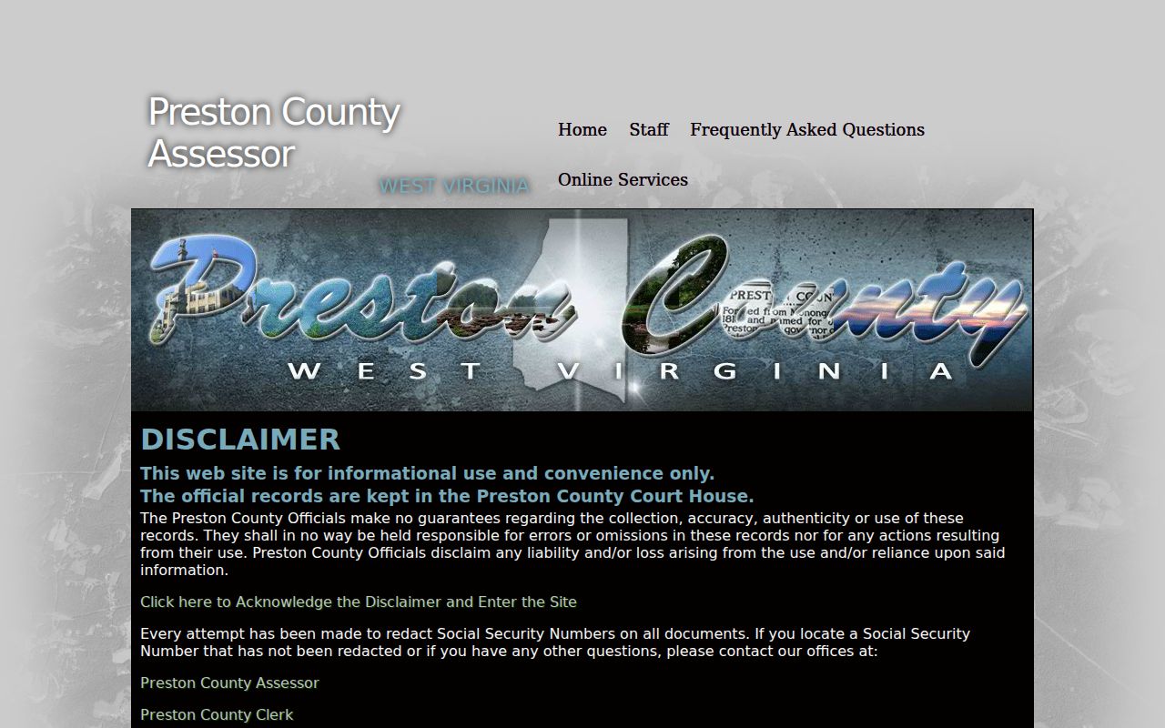
The Assessor's entry page ties the property search to other county services. A zero-result query often means a spelling slip or an over-tight filter, not a missing deed.
The mapWV assessment search shows owner, district, street, and parcel filters.
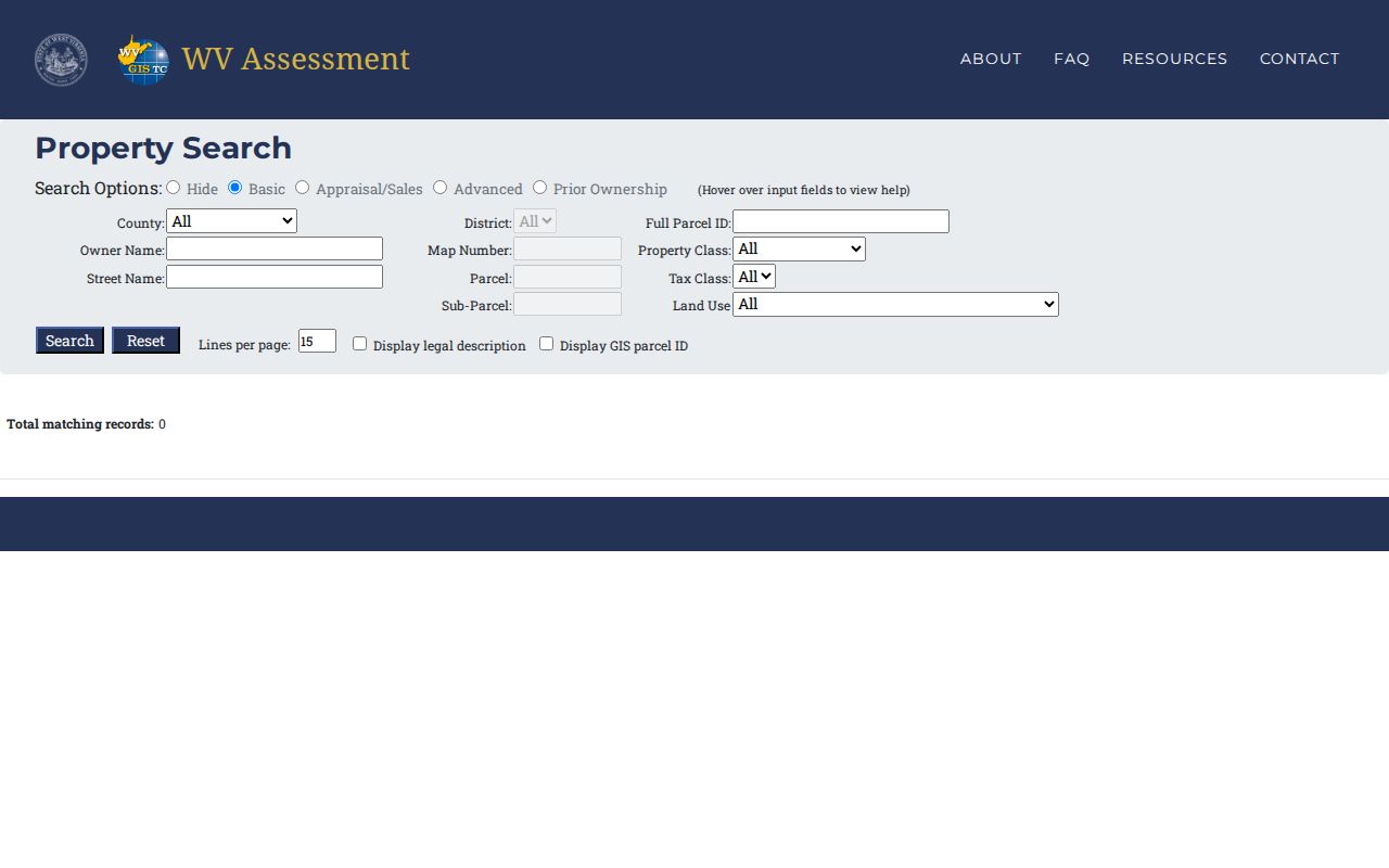
The labeled view makes each Preston County field easy to spot before you search. Copy values exactly as shown, and ask the Assessor about any field that looks missing or has changed on a live result.
Preston County Search by Street and Owner
Every search key gives up reach to gain precision. A Street Name query works well when the address is known. The map number may not be. It can return a run of nearby Preston parcels at once. The form offers no separate street-number field, though. The results can look like a block of matches. Confirm which row fits a house number by comparing the situs and legal description. Use a map, too. It keeps you from attaching the wrong owner of record to a neighboring parcel.
Owner Name can turn up more than one property tied to a person or entity. It can also miss a deed grantee. The tax roll may list an estate, a trustee, an LLC, or plain initials instead. Spelling drift causes the same trouble. Try the exact roll spelling first. Then separate same-name hits with a mailing address or a parcel clue. Confirm a match first. The full Parcel ID then becomes the strongest way to repeat the search. The county publishes no punctuation or leading-zero rules for it. Never reformat it by guess.
| Starting clue | Useful for | Limit in Preston County |
|---|---|---|
| Street Name | Locate candidate parcels on a known road | Number-level matching was not visible |
| Owner Name | Find tax-roll entries tied to a name | Roll styling can differ from a deed |
| Map / Parcel / Sub-Parcel | Return to a known assessment card | Preserve components as shown |
A mailing address exists for notices. It proves neither situs nor occupancy. A rural route, community name, or postal city can still help you search Preston County property records, even when it differs from the official parcel description.
Read a Preston County Property Search Result
An assessment result is a compact tax record, not a deed abstract. Its controls and filters point to owner and mailing information. They also cover situs and street, county and district, and parcel components. Classification, use, appraisal, and acreage appear in the same record, along with sales and deed book and page. Legal description, building traits, and a GIS parcel key round out the fields. Two options add extra detail to a result. These are "Display legal description" and "Display GIS parcel ID." Field availability can vary by record. Check the live Preston County property search. It shows which fields a particular parcel fills in.
| Owner of record | Name used on the current assessment entry |
|---|---|
| Situs / mailing | Parcel location label and tax correspondence destination |
| Parcel key | County, district, map, parcel, and sub-parcel; exact punctuation unverified |
| Land / building / total appraisal | Separate value components; note the year and portal label |
| Legal description | Deed wording used to link the assessment to land |
| Sale and deed reference | Sale date/price filters and book/page clues where present |
A Preston County property search result is a starting point, not a title opinion. It does not prove the listed owner of record still holds the land. Someone may have recorded a later deed. Treat the mapped lines as approximate. Confirm boundaries with a recorded plat or a survey before relying on them.
Timing matters too. A result can go stale when a deed lands near or after the July 1 assessment date. Check the latest recorded instrument before you treat any parcel number as final.
Preston County Property Address Variants
Rural searches rarely run on street addresses alone. Roads get abbreviated, and a mailing city may mark a post office rather than a real municipal boundary. Properties can also go by a nearby community's name. Terra Alta shows the problem well. An older deed or a local history may call the same place Portland, Cranberry Summit, or just Cranberry. When a modern street query returns nothing, try those historic names. Then tie the name to the legal description and the parcel map. Never assume it marks the same tract.
Kingwood has the same edge problem. A Kingwood mailing address can sit outside the incorporated city line, while the assessor's tax class separates property inside a municipality from certain property outside it. Masontown's postal map also reaches past the town edge. Use the street field to build a candidate list. Compare situs, district, map, parcel, and municipal location. A shared map number alone proves nothing, so weigh several fields before settling on one parcel row. The county publishes no crosswalk of ZIP codes to parcel-number ranges.
The county records hub carries an Addressing link. For a corrected or historic E911 address, ask the custodian which current or prior address field is searchable.
Preston County Prior Owner Search
mapWV offers a Prior Ownership mode. The Assessor's scanned Map Cards and Land Books open a second path through assessment history. Treat Prior Ownership as a lead. It never replaces the deed chain. It publishes no coverage years, row limits, or output format. Write down the current parcel key first. Then ask whether a prior map number, tax-book page, or card scan can be pulled for the year you need.
Preston Assessor Online Services lists the full toolkit: Property Record Search, Sales Record Search, Map Cards, Land Books, Levy Rates, a Tax Estimator, and tax-inquiry links. The Land Book Viewer exposes District, Year, and Page controls. The scanned-map-card page holds current and historical cards. It publishes no year span. A tax entry can point to an earlier roll owner or a tract size. Only the recorded deed gives the transfer date, the parties, and the legal description.
When the web path runs out, take the parcel clue to the Assessor counter. Ask for the exact historical card or land-book page. Keep its year and page in your notes.
Preston County Tax Ticket Search Fields
The Sheriff's Tax Office portal answers a different question. It belongs in the toolbox whenever the issue is a bill or a payment. Published controls include taxpayer name in last-name-first order, account, tax year, ticket and suffix, district, map, parcel, sub-parcel, year, and Real or Personal property. These are ticket-search keys. They are not the Assessor's owner or parcel result. A shared name or map number does not by itself prove the ticket belongs to your property.
Start with the tax year and ticket if a prior bill is in hand. Otherwise use district and parcel components. Then check the portal's returned taxpayer and property fields before trusting a match. The portal does not display its result layout, covered years, payment methods, or online receipt copies. Call the Sheriff's Tax Office at 304-329-0105 for a ticket question the live page cannot resolve.
A tax ticket answers a payment-status question. It does not replace the recorded deed. It cannot establish who holds title. Keep three keys in separate notes when reconciling a record: the tax account, the deed book and page, and the assessment parcel key.
Choose a Preston County Property Search Key
Pick one key to start. Use the address when it is the only clue, the owner when the roll spelling is known, and parcel components when an earlier result supplies them. Don't stack every filter on the first attempt. If no row appears, drop the narrowest uncertain choice, try the road name without a house number, and check historic place names. Once a result appears, compare at least two fields beyond the name. Only then treat it as the right parcel.
| Search Key | Best For | Where It Works | Watch Out |
|---|---|---|---|
| Street | Locate candidates on a known road | mapWV, then Atlas | Number-level matching was not visible |
| Owner name | Find tax-roll entries tied to a name | mapWV assessment | Trust, estate, LLC, spelling, or same-name differences |
| Parcel components | Return to a known assessment card | Assessor and mapWV | Preserve the exact displayed format |
Not a title search. A Preston County assessment result names the roll owner and describes tax characteristics. It does not establish clear title; the recorded instrument and a full title review answer that separate question.
- Owner of record
- The name carried on the assessment roll at the time shown.
- Situs
- The location associated with the parcel, distinct from a mailing address.
- Parcel ID
- A county assessment and map key, not the land description itself.
- Legal description
- The deed wording that describes the tract in the recorded instrument.