
Find Preston County Property Records
Start with the question, not the search box. An address or owner name goes into the Assessor's property search first. That lookup can surface the district, map, parcel, and sub-parcel numbers. It also gives the situs, mailing address, assessed fields, deed-book reference, and legal description. The parcel key ties everything together. Once you know it, that identifier carries you across every county system.
Recorded instruments live elsewhere. A deed, mortgage, lien, release, easement, or plat belongs in the Preston County Clerk's Document Inquiry. The Sheriff's Tax Office handles tax tickets and payments. The Atlas map adds context but never replaces the recorded description. A practical route keeps the offices straight. Pull the assessment record. Save the parcel number and legal description. Then read the newest recorded instrument. Check the tax ticket only if payment is the question. For a line on the ground, compare the mapped parcel with the recorded plat, and use a surveyor when exact boundaries matter. The county's public pages warn that web data may be incomplete or wrong. Courthouse records remain official.
- Search the Assessor or mapWV for the street, owner, or parcel; select Preston County and a district when known.
- Turn on the legal-description and GIS-ID result options, then keep the map, parcel, and sub-parcel parts together.
- Use the owner name and legal description in the County Clerk index and read the newest deed before relying on the tax roll.
- Open Atlas for location context and use Sheriff Tax Inquiry for the separate ticket or paid/unpaid question.
- If the index or image is missing, ask the custodian for the public terminal, book/page search, copy type, and current fee.
Preston County Property Records Offices
Kingwood puts three county counters at one street address. Each answers a different question. The Clerk keeps land documents in Suite 103, while the Assessor's roll and map-card services sit in Suite 101. The Sheriff Tax Office works out of Suite 102. The arrangement makes one trip enough to reconcile a deed, an assessment, and a tax ticket. Calling ahead still saves time. If the request depends on an older book, a certified copy, or a fee the public pages do not state, ask the right office before traveling.
Preston County Clerk
106 W. Main Street, Suite 103
Kingwood, WV 26537
304-329-0070
Preston County Assessor
106 W. Main Street, Suite 101
Kingwood, WV 26537
304-329-1220
Preston County Sheriff Tax Office
106 W. Main Street, Suite 102
Kingwood, WV 26537
304-329-0105
Preston County Property Records: One-Trip Route
Kingwood's courthouse cluster makes in-person follow-up practical. At the Clerk's counter, ask for the deed or index entry tied to the parcel's legal description. Note the book and page or instrument reference. There you can compare the owner-of-record field, mailing address, situs, and map-card history. The Sheriff can then check a tax year and ticket. That step keeps tax status separate from ownership. The sequence helps even when web screens use different names for the same tract.
The Clerk's public page covers more than land. It lists document inquiry, probate and estate administration, marriages, elections, and military discharges. A land question may need an index entry, a deed image, or a copy. Some requests are for a plain copy. Others need a certified copy. Those are different services. The page states a minimum $2 convenience charge for debit or credit card payments beginning January 1, 2023. It does not publish every copy charge. Ask the office to confirm the current amount. Also ask whether a counter visit is required.
The county's Online Records hub links the Assessor, Clerk, addressing information, and tax inquiry. It is a handy fallback when a bookmark fails. Each office stays responsible for its own records.
The county online records hub lists the official routes for property-related services.
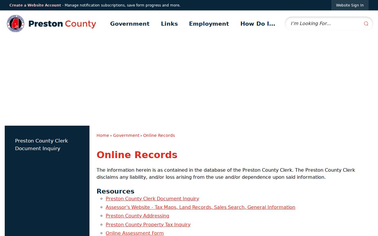
The image shows the county's Online Records hub. It does not merge deed, assessment, tax, and GIS results into one official record.
Preston County Property Search Fields
The statewide mapWV assessment interface offers far more than a street box. Four modes are available: Basic, Appraisal/Sales, Advanced, and Prior Ownership. Every filter is optional. Layering on too many at once can bury a Preston County parcel that really exists. So start with one strong clue. Pick the county first. Then add a district, map, or parcel number only when the results need narrowing.
| Search field | What it helps locate | Use with care |
|---|---|---|
| Owner Name / Street Name | Candidate parcels for a person or road | Same names and rural address variants need review |
| Full Parcel ID; Map, Parcel, Sub-Parcel | A keyed assessment record | Exact punctuation and leading zero rules were not published |
| Mailing Address / Legal Description | Tax correspondence or deed wording | Neither field is a substitute for situs or a survey |
| Deed Book / Page | A recorded-reference clue | Confirm the instrument with the County Clerk |
| Sale dates, price, value, acreage ranges | Appraisal and sales candidates | A range is a filter, not a valuation conclusion |
| Flood Hazard, building year/area, structure counts | Property characteristics | Portal options and coverage details can vary |
The mapWV assessment search includes two extra switches worth knowing about. One is “Display legal description.” The other is “Display GIS parcel ID.” Turn both on whenever you plan to carry a result into a deed search or a county GIS map lookup, since the parcel number and legal text give you something concrete to match against the Clerk’s deed records.
The state assessment page displays filters that can help locate a Preston parcel.
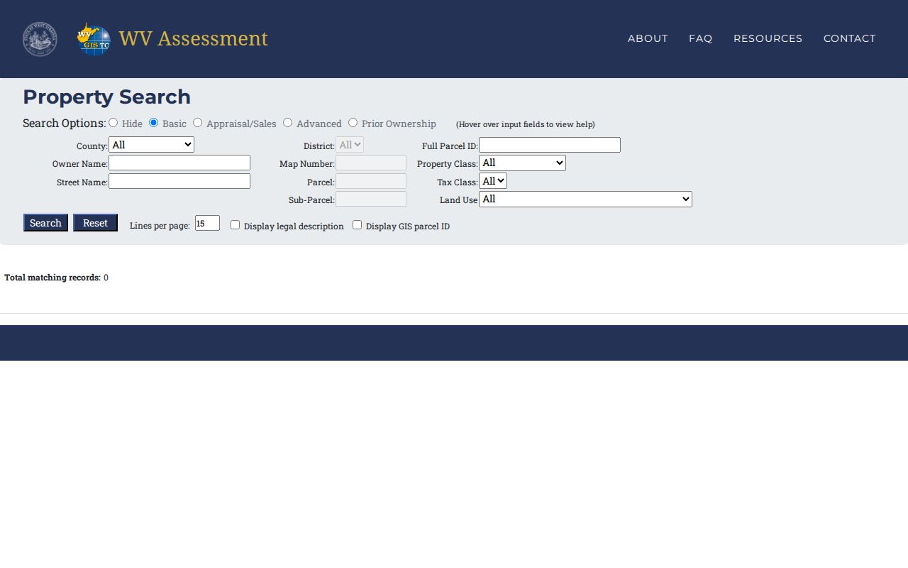
Use the search page as a field guide rather than a finished answer. Save the exact parcel number components a live result shows you. Then confirm them with the Assessor’s office before you rely on that identifier as a complete legal description for any deed or plat work.
Preston County Property Record Types
Preston County property records live in four places. The land index, the tax roll, the Sheriff’s ticket system, and the mapped parcel layer each hold a different piece of the picture. One address can thread through all four. The Clerk’s recorded instrument settles conveyances and land liens. The Assessor’s record carries the tax-roll owner of record. It also holds the appraisal value, the property class, and parcel details. The Sheriff’s account tells you whether the tax bill is paid. The map layer shows where a parcel sits and who its neighbors are. Knowing which office answers which question makes any Preston County property search far faster.
| Record Type | What It Documents | Kept By | Access |
|---|---|---|---|
| Deeds and land instruments | Transfers, security interests, releases, easements, plats | Preston County Clerk | Document Inquiry or courthouse counter |
| Assessment roll and map cards | Owner of record, situs, mailing, values, class, land history | Preston Assessor | Online search and scanned records |
| Tax tickets | Tax year, ticket, taxpayer, parcel, paid/unpaid status | Sheriff Tax Office | Inquiry portal and office |
| GIS parcel layer and plats | Location, mapped shape, lot references, nearby parcels | Assessor/GIS and County Clerk | Atlas, mapWV, recorded plat |
| Permits and zoning | Municipal approvals and local land-use decisions | Relevant town office | Ask the municipality; public search was not found |
Match the record to the question. A deed proves a transfer or other recorded act. An assessment card reports the county's tax classification and value fields. A tax ticket shows payment, and GIS supports location research. Kingwood, Terra Alta, and Masontown may hold local permits or zoning records. But no citywide searchable permit index exists for them. Ask the relevant municipal office about its coverage and request route. Keep the detailed Preston County deed-record process and tax workflows separate from a parcel search.
Preston County Property Tax Assessment
West Virginia assesses property on July 1 each year at its true and actual value. Taxable value is generally 60 percent of that amount. That ratio is statutory, not market pricing. No Preston County parcel should be expected to sell for its implied number, since the framework sets assessment math rather than price. Assessor records often split land, building, and total appraisal. Read the year and label beside each figure, and keep those amounts distinct from the last recorded sale price.
The Assessor's FAQ lays out the county calendar. Property is valued on July 1, and annual tax tickets go out by July 15. September 1 brings the first-half payment deadline plus Farm Use filing and Managed Timberland applications. Second-half payment is due March 1. A qualifying real-property assessment increase has its own statutory notice process, which can require notice by January 15 once the increase passes the legal threshold. Value appeals must be completed by January 31. The Board of Equalization and Review meets in February by appointment. Confirm current forms and dates with the Assessor.
Class 2 covers owner-occupied or farmed property under the FAQ. Class 3 covers non-Class-2 property outside a municipality. Class 4 covers comparable property inside one. The classification can affect levy treatment. A postal city alone does not prove a parcel sits inside municipal limits, so verify the boundary before assuming.
The Preston Assessor FAQ and state assessment provisions explain the local dates and ratio. A value page should still name the actual record year and never convert an assessment into a sale estimate.
West Virginia Code explains assessment notices and the review process.
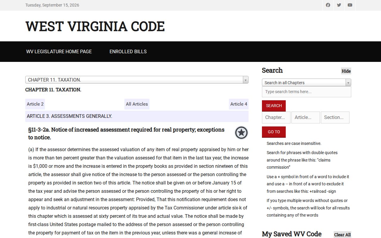
The notice explains the process. Parcel-specific values stay in the county roll, and any review request should name the parcel and follow the Assessor's current directions.
Preston County Property Records and Tax Tickets
The Sheriff's Tax Office runs a search quite different from the Assessor's roll. Its online inquiry accepts a last-name-first taxpayer name, account, tax year, ticket and suffix, district, map, parcel, and sub-parcel. It also takes a year and a Real or Personal flag as clues. Start with the Assessor parcel key. Then check the ticket's year and taxpayer fields before trusting any match. The portal publishes no details on its result layout. It says nothing about payment methods, covered years, or downloadable receipts.
A paid or unpaid ticket settles a tax-payment question. It does not establish title. For a conveyance, the County Clerk's recorded deed governs; for assessed value, the Assessor's roll. When the portal returns no clean match, call the Tax Office at 304-329-0105 with the district and parcel components. That beats guessing from a name.
Preston County Property Records in Older Books
Online tools do not expose every chapter of the county's property history. The Assessor posts scanned current and historical map cards. A Land Book Viewer offers District, Year, and Page controls. The public pages state no exact year range. These scans can bridge an old owner name or map number to a present parcel, but the Clerk's deed book remains the legal source for transfers and land descriptions.
Preston County was formed in 1818 from Monongalia County. The Clerk can confirm which deed-book years, grantor indexes, plat volumes, or microfilm runs are searchable online and at the counter. A web search ends somewhere. When it does, ask staff for both grantor and grantee indexes. Bring the parcel's legal description, prior owner names, book and page references, and approximate dates. WVU Regional History Center records include Preston maps dated 1976–1980. Its genealogical material spans a much wider period.
The official county archive has keyword and date-range controls. It can surface minutes, notices, or local records tied to a property story. It is a discovery aid, not a deed substitute.
The Assessor's Land Book Viewer works best when a parcel's district and older page reference are known. Preserve the year and page with the name. Another tax year may show a changed tract.
The Assessor’s online services include a land-book viewer for district, year, and page searches.
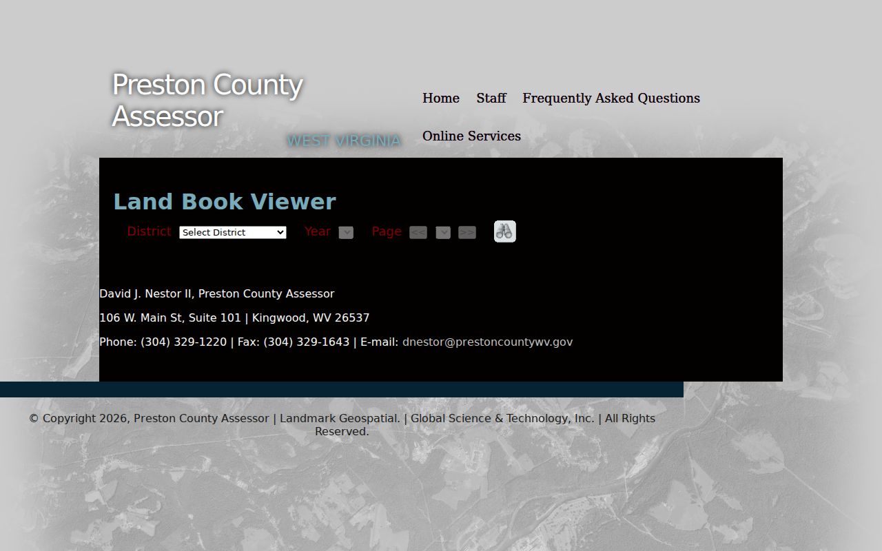
Pair any old tax entry with the deed and the map card first. Only then treat it as the same parcel as today.
Preston County Deed and Estate Transfers
Probate explains many assessment name changes. When an owner of record dies, the tax-roll account can shift to an executor, administrator, heir, trust, or buyer. The County Clerk handles Probate and Estate Administration. Search the estate under the decedent's name, then connect any executor's deed, affidavit, will, appointment, or court order to the land record. A death certificate can support identity work. It does not convey the property.
Keep the steps separate for family land. The Assessor holds the parcel and current tax-roll name. The Clerk keeps the estate file. Finish by confirming the transfer in the recorded deed index. The Clerk publishes no description of its online probate fields or historic coverage, so ask the counter which index and copy request fits your date. Sealed or protected material can stay off limits even when the related deed is public.
West Virginia Vital Registration issues certified vital certificates under state access rules. Birth records open after 100 years. Death, fetal-death, marriage, and divorce or annulment records generally open after 50 years, subject to protected fields and eligibility rules for current records. The Preston County Clerk serves as a local contact for county indexes and marriage licenses, while the state repository issues the certified copies.
When the question is a prior owner rather than an estate record, the backward deed-chain method is the right next step. It follows the conveyances themselves. A family relationship alone never establishes title.
Preston County Archive Property Clues
The county archive search accepts keywords, dates, and categories. It works well when a property question begins with a road, railroad, place name, or county project. Expect meeting items, public notices, and local history references. The archive is a separate information source. It is not the deed index or a parcel-account lookup. Use an archive result as context for a sharper request to the Clerk, Assessor, or town office.
Try a distinctive term first. Then vary the spelling or the date range. Keep the item title and date with your notes. The county's 2025 meeting record mentioned an M&K Railroad exhibit and open house at Masontown Trailhead Park. That supports a place-name lead, but it does not prove a right-of-way, lot line, ownership, or subdivision name.
The County Archive lets visitors search public material by keyword, date, or category.
Treat items like these as background only. A land or tax fact still needs verification with the office that keeps the official record.
Preston County Property Address Clues
A postal city, a municipal boundary, and an assessor situs field can differ. Each may describe a different place. Kingwood, Terra Alta, and Masontown are county communities. A mailing address that names one town proves little. It does not prove the parcel sits inside its incorporated limits. That matters when you read a tax class or ask a town about zoning. Preserve the full street and legal-description details. Then check the municipal line on a map or with the local office.
Terra Alta has worn several names: Portland, Cranberry Summit, Cranberry, and Terra Alta. Older deeds and local histories may use any of them. Kingwood's history carries two dates with different meanings. A local timeline begins the town-site story in 1797. The official profile gives 1815 as the founding. Keep the source language attached to each date instead of blending them. Masontown's documented town layout dates to 1856. That is a useful lead when an older parcel description leans on roads, churches, stores, or railroad references.
The county's community timeline supplies historical place-name clues. Current ownership and parcel boundaries still need the Assessor, Clerk, and GIS record. Local context helps choose search terms. It is not evidence of title.
The county’s community history index supplies place-name context for older property references.

Let the timeline sharpen your search terms. The parcel key and recorded land description still give the legal match.
Limits of Preston County Property Records
Preston County public records show what was assessed, indexed, filed, or mapped at a point in time. A deed awaiting indexing may not appear. Neither will an unrecorded agreement, a current occupancy, or a boundary as a surveyor would locate it. The Clerk's Document Inquiry page warns that its data may not be accurate or authentic. It also flags attempted redactions of Social Security numbers. Treat any online result as a locator. Verify a consequential point with the custodian.
Lawful use. Use owner and parcel records for property research, transaction due diligence, tax review, and civic oversight. A search is not a title opinion or boundary survey. Do not use personal information to stalk, harass, threaten, or harm anyone.
When a record is not online, West Virginia's Freedom of Information Act allows a request to the public body that holds it. The Secretary of State's FOIA page says requests go to the creating or maintaining agency. A central statewide office is not the target. Name the parcel, instrument, date range, preferred format, and a reasonable copying-cost limit. The law has limits of its own. It never turns a GIS map into a survey. It cannot require a custodian to create new analysis. The West Virginia FOIA information page provides request-routing guidance. For Preston land, the custodian may be the Clerk, Assessor, Sheriff, county archive, or relevant town office depending on the record.